Showing posts with label Tourism. Show all posts

Si Gale Gale Dancing Puppet

Tuesday, October 4, 2011 0 comments

Versatile Zone before the Indonesian Pavilion at World Expo 2010 Shanghai to visitors passing through the room is dominated by black and the color named Black Box is Gale-Gale. Here is a statue of the puppet, which is a Si-Gale, Gale, himself. Mainly made of wood and iron, a little 'ornament wearing a traditional dress in North Sumatra, Gale, Gale, recalls an adult friend. And this doll can dance.

Si-Gale, Gale doll is used in a ritual held for two months after the death of a rich person has no descendants. This doll is Lumbang Gambira, Negri Garoga, Samosir, and the border was Gayus Horb ugly. A puppet to represent the deceased, who asked not to cause damage is a living being, or revenge, because they died without problems, with the consequence of their status in the next word is reduced.

The puppets will perform the funeral dance called Tor Tor-Si Gale Storm. The purpose of dance is to dispel the disappointment of deaths because of their lack of offspring. Batak believe that to die without children, especially the son, is the destination town. Their souls are forced to travel Middle Earth with no family to pray for them. According to local custom, after the funeral of Si-Gale Gale is supposed to be destroyed.

Special person named Datu had the honor to manipulate the strings to make Si-Gale, Gale, a funeral dance, drag springs hidden in the wooden box in which is considered the Si-Gale, Gale. Si-Gale, Gale, a traditional Batak dance music in the background. In the original version of the music played live, but now the music of reproductive technology advances and practical reason. Although rare in a quiet, Si-Gale, Gale, dance is one of the tourist attractions in Samosir, an island in the middle of Lake Toba, North Sumatra. At the same time, puppet shows in Indonesia is a courtesy Art Pavilion

Musi River – Largest and Longest River in Sumatra Island Indonesia

Sunday, October 2, 2011 0 comments

Musi River Tours of Palembang

You will find something missing if you visit Palembang, without taking an excursion on the river Musi. This river is the longest known in Sumatra by 750 km long. The trip on the river Musi is a must for visitors who want to know Palembang in the past. Long ago, the indigenous people of Palembang lived along this river. Some have even built their houses along the shore. When you take the tour, you can find several attractions such Kemarau Island and temples. Local people depend on this river for transportation. You can see the many motorboats (taxi), as passengers on the other side of river.

Getting there

You can visit Palembang Sultan Mahmud Badaruddin II International Airport in Tanjung Api Api Street, which is available from Malaysia, Singapore, Thailand and China. To go to the Musi River, you can take a taxi or rental car at the airport. The distance between the airport and downtown is about 6 km.

Riverin downtown musicians, there are nine forms of public transport, including buses from seven different locations, which can take you for only Ampera RP1, RP5 to 500, 000

Move

To travel around the Musi river, you should use a motorboat. You can rent one in Ampera bridge in front of Sultan Mahmud II Badaruddin Museum, or in front of Fort Kuto Besak. There are several types of motor boats such as speedboats, Ketek, and smaller vessels. Their prices range from RP20, 000 to RP100, 000 (or 2 to 10 US Dollars). Do not pay more than if those rates. After that, you can enjoy the river Musi taking tour.

Do

Along the Musi River, there are several attractions Kemar island and the tomb of Ratu Bagus Kuning. You can ask the driver of the boat to go to these sites. No doubt aware of these areas.

Residence

As the place chosen for the national sports event Palembang, Palembang developed rapidly and is therefore easy to find hotels in the city center. You will find the stars, or ordinary hotels along the Riva captain, Sudirman, R Sukamto, a veteran, and POM ninth Streets.

Eat

You will have no difficulty finding local food here. Not far from the Grand Mosque in Palembang, Palembang, you can enjoy traditional food-empek empek Panggang and kerupuk (crackers) to Rp1, 500 and RP22, 200

per room, depending on where you eat. There is also a stand selling food ACE Belimbing (Star fruit ice cream). This is the only food stall that sells art Belimbing. His name is Ujuk.

On the Musi River, there are floating restaurants where you can improve your culinary experiences in Palembang.

I'll buy

You will find souvenirs near the Musi River, or you can simply walk 1-2 km from Sultan Mahmud Badaruddin II museum, and you will find two Seeling markets a variety of food and souvenirs, such as fruits and songket (cloth). These markets are called Pasar 16 Ilir, and Pasar 35 Ilir. About two miles away, is the center songket and 50 meters from there you will find Lekeur (sculpture) center.

Advice

Palembang weather is hot as Jakarta, then you should wear light cotton. And do not forget to bring your hat or umbrella for sun protection.


Source

Indonesia's Geography

0 comments

IMG_0459.JPG (59503 bytes)
Indonesia is the largest archipelago in the world. It consists of five major islands and about 30 smaller groups. The figure for the total number of islands is 17,508 according to the Indonesian Naval Hydro-Oceanographic office. The archipelago is on a crossroads between two oceans, the Pacific and the Indian ocean, and bridges two continents, Asia and Australia. This strategic position has always influenced the cultural, social, political and economic life of the country.
The territory of the Republic of Indonesia stretches from 6o08' north latitude to 11o15' south latitude, and from 94o45' to 141o05' east longitude. The Indonesian sea area is four times greater than its land area, which is about 1.9 million sq. km. The sea area is about 7.9 million sq. km (including an exclusive economic zone) and constitutes about 81% of the total area of the country.
The five main islands are: Sumatra, which is about 473,606 sq. km. in size; the most fertile and densely populated islands, Java/Madura, 132,107 sq. km; Kalimantan, which comprises two-thirds of the island of Borneo and measures 539,460 sq. km; Sulawesi, 189,216 sq. km; and Irian Jaya, 421,981 sq. km, which is part of the world's second largest island, New Guinea. Indonesia's other islands are smaller in size.
The archipelago is divided into three groups. The islands of Java, Sumatra and Kalimantan, and the small islands in-between, lie on the Sunda Shelf which begin on the coasts of Malaysia and Indo China, where the sea depth does not exceed 700 feet. Irian Jaya which is part of the island of New Guinea, and the Aru Islands lie on the Sahul Shelf, which stretches northwards from the Australian coast. Here the sea depth is similar to that of the Sunda Shelf.

Located between these two shelves is the island group of Nusatenggara, Maluku and Sulawesi, where the sea depth reaches 15,000 feet. Coastal plains have been developed around the islands of Sumatra, Java, Kalimantan and Irian Jaya.
The land area is generally covered by thick tropical rain forests, where fertile soils are continuously replenished by volcanic eruptions like those on the island of Java.
The country is predominantly mountainous with some 400 volcanoes, of which 100 are active. Mountains higher than 9,000 feet are found on the islands of Sumatra (Mt. Leuser and Mt. Kerinci), Java (Mt. Gede, Mt. Tangkubanperahu, Mt. Ciremai, Mt. Kawi, Mt. Kelud, Mt. Semeru and Mt. Raung), Sulawesi (Mt. Lompobatang and Mt. Rantekombala), Bali (Mt. Batur and Mt. Agung), Lombok (Mt. Rinjani) and Sumbawa (Mt. Tambora). The highest mountain is the perpetually snow-capped Mandala Top (15,300 feet) in the Jaya Wijaya mountain range of Irian Jaya.
Many rivers flow throughout the country. They serve as useful transportation routes on certain islands, for example, the Musi, Batanghari, Indragiri and Kampar rivers in Sumatra; the Kapuas, Barito, Mahakam and Rejang rivers in Kalimantan; and the Memberamo and Digul rivers in Irian Jaya. On Java rivers are important for irrigation purposes, i.e., the Bengawan Solo, Citarum and Brantas rivers.
A number of islands are dotted with scenic lakes, like the Toba, Maninjau and Singkarak lakes on Sumatra; the Tempe, Towuti, Sidenreng, Poso, Limboto, Tondano, and Matana lakes on Sulawesi; and the Paniai and Sentani lakes on Irian Jaya.

CLIMATE AND WEATHER
The climate and weather of Indonesia is characterized by two tropical seasons, which vary with the equatorial air circulation (the Walker circulation) and the meridian air circulation (the Hardley circulation). The displacement of the latter follows the north-south movement of the sun and its relative position from the earth, in particular from the continents of Asia and Australia, at certain periods of the year. These factors contribute to the displacement and intensity of the Inter-Tropical Convergence Zone (ITCZ) which is an equatorial trough of low pressure that produces rain. Thus, the west and east monsoons, or the rainy and dry seasons, are a prevalent feature of the tropical climate.
The Main Seasons
The climate changes every six months. The dry season (June to September) is influenced by the Australian continental air masses; while the rainy season (December to March) is the result of the Asian and Pacific Ocean air masses. The air contains vapor which precipitates and produces rain in the country. Tropical areas have rains almost the whole year through. However, the climate of Central Maluku is an exception. The rainy season is from June to September and the dry season from December to March. The transitional periods between the two seasons are April to May and October to November.
Temperature and Humidity
Due to the large number of islands and mountains in the country, average temperatures may be classified as follows:
coastal plains: 28oC
inland and mountain areas: 26oC
higher mountain areas: 23oC, varying with the altitude.
Being in a tropical zone, Indonesia has an average relative humidity between 70% and 90%, with a minimum of 73% and a maximum of 87%.


TERRITORIAL WATERS AND EXCLUSIVE ECONOMIC ZONE
When independence was proclaimed and sovereignty gained, Indonesia had to enact laws to govern the seas in accordance with the geographic structure of an archipelagic state. This, however, did not mean that the country would bar international passage. The laws were necessary instruments for the unity and national resilience of the country, with a territory that embraces all the islands, the islets and the seas in between.
In view of the country's susceptibility to foreign intervention from the sea and for domestic security reasons, on December 13, 1957, the Indonesian Government issued a declaration on the territorial waters of the Republic. It stated that all the waters surrounding and between the islands in the territory came within Indonesia's sovereignty. It also determined that the country's territorial water limit was 12 miles, measured from a straight baseline drawn from the outermost points of the islands.
In the past, archipelagic states like Indonesia have unilaterally determined their 200-mile-Exclusive Economic Zones. Today such economic zones are confirmed by the International Convention on the Law of the Sea, which was ratified by the Indonesian Government on October 18, 1983, by Act No. 5 of the same year. This is the legal basis of the Indonesian-Exclusive Economic Zone.


IMG_0205.JPG (82985 bytes)
FLORA
The rich flora of Indonesia includes many unique varieties of tropical plant life in various forms. Rafflesia arnoldi, which is found only in certain parts of Sumatra, is the largest flower in the world. This parasitic plant grows on certain lianas but does not produce leaves. From the same area in Sumatra comes another giant, Amorphophallus tatinum, the largest inflorescence of its kind.
The insect trapping pitcher plant (Nepenthea spp) is represented by different species in many areas of western Indonesia.
The myriad of orchids is rich in species, varying in size from the largest of all orchids, the tiger orchid or Grammatophyllum Speciosum, to the tiny and leafless species of Taeniophyllum which is edible and taken by the local people as a medicine and is also used in handicrafts. The forest soil is rich in humus which enables the luxuriant growth of a multitude of fungi, including the horse hair blight, the luminescent species, the sooty mold and the black mildew.
Indonesia's flora also abounds in timber species. The dipterocarp family is renowned for its timber (meranti), resin, vegetable oil and tengkawang or illipe nuts. Ramin, a good-quality timber for furniture, is produced by the Gonystylus tree. Sandalwood, ebony, ulin and Palem-bang timber are other valuable forest products. Teakwood is a product of man-made forests in Java.
Because the flora is so rich many people in Indonesia have made a good living of this natural resource. About 6,000 species of plants are known to be used directly or indirectly by the people. A striking example in this modern time is the use of plants in the production of traditional herbal medicine or "Jamu". Flowers are indispensable in ceremonial, customary and traditional rites.
To care for animals and plants in the country, the fifth of November was designated as the national Flora and Fauna Day. To foster the society's love for its fauna and flora, the Komodo reptile (Varanus komodoensis) has been designated as Indonesia National Animal, the red freshwater Liluk/arwana (Scleropage formosus) as the Fascinating Animal and the flying Elang Jawa (Javan Hawk Eagle, Spizaetus bartelsi) as the Rare (endangered) species. These decisions complement the previous designation of Indonesia's national flowers.
IMG_0440.JPG (84789 bytes)

INDONESIA STANDARD TIME
As of January 1, 1988, Indonesia's three time zones have been changed as below:
  1. Western Indonesia Standard Time equals GMT plus 7 hours (meridian 105oE), covering all provinces in Sumatra and Java, and the provinces of West and Central Kalimantan.
  2. Central Indonesia Standard Time equals GMT plus 8 hours (meridian 120oE), covering the provinces of East and South Kalimantan, all provinces in Sulawesi, and the provinces of Bali, West and East Nusatenggara and East Timor.
  3. Eastern Indonesia Standard Time equals GMT plus 9 hours (meridian 135oE), covering the provinces of Maluku and Irian Jaya.

Location:
Southeastern Asia, archipelago between the Indian Ocean and the Pacific Ocean

Geographic coordinates:
5 00 S, 120 00 E

Area:
total: 1,904,569 sq km
country comparison to the world: 16
land: 1,811,569 sq km
water: 93,000 sq km

Area - comparative:
slightly less than three times the size of Texas

Land boundaries:
total: 2,830 km
border countries: Timor-Leste 228 km, Malaysia 1,782 km, Papua New Guinea 820 km

Coastline:
54,716 km

Maritime claims:
measured from claimed archipelagic straight baselines
territorial sea: 12 nm
exclusive economic zone: 200 nm

Climate:
Current Weather
tropical; hot, humid; more moderate in highlands

Terrain:
mostly coastal lowlands; larger islands have interior mountains

Elevation extremes:
lowest point: Indian Ocean 0 m
highest point: Puncak Jaya 5,030 m

Natural resources:
petroleum, tin, natural gas, nickel, timber, bauxite, copper, fertile soils, coal, gold, silver

Land use:
arable land: 11.03%
permanent crops: 7.04%
other: 81.93% (2005)

Irrigated land:
45,000 sq km (2003)

Total renewable water resources:
2,838 cu km (1999)

Freshwater withdrawal (domestic/industrial/agricultural):
total: 82.78 cu km/yr (8%/1%/91%)
per capita: 372 cu m/yr (2000)

Natural hazards:
occasional floods; severe droughts; tsunamis; earthquakes; volcanoes; forest fires
volcanism: Indonesia contains the most volcanoes of any country in the world - some 76 are historically active; significant volcanic activity occurs on Java, western Sumatra, the Sunda Islands, Halmahera Island, Sulawesi Island, Sangihe Island, and in the Banda Sea; Merapi (elev. 2,968 m, 9,737 ft), Indonesia's most active volcano and in eruption since 2010, has been deemed a "Decade Volcano" by the International Association of Volcanology and Chemistry of the Earth's Interior, worthy of study due to its explosive history and close proximity to human populations; other notable historically active volcanoes include Agung, Awu, Karangetang, Krakatau (Krakatoa), Makian, Raung, and Tambora

Environment - current issues:
deforestation; water pollution from industrial wastes, sewage; air pollution in urban areas; smoke and haze from forest fires

Environment - international agreements:
party to: Biodiversity, Climate Change, Climate Change-Kyoto Protocol, Desertification, Endangered Species, Hazardous Wastes, Law of the Sea, Ozone Layer Protection, Ship Pollution, Tropical Timber 83, Tropical Timber 94, Wetlands
signed, but not ratified: Marine Life Conservation

Geography - note:
archipelago of 17,508 islands (6,000 inhabited); straddles equator; strategic location astride or along major sea lanes from Indian Ocean to Pacific Ocean
 

Paradise Bird Papua

Saturday, October 1, 2011 0 comments


The largest of the border and the lush forests of Papua is home to some of the most glorious birds on earth. Anyone who has followed the almost mythical paradise of birds do something very intimate acclaimed BBC nature documentary, "Attenborough in Paradise," destined to be a long never see the real thing. But in West New Guinea with a population of different bird is much more to offer than a haven for birds alone ...

Think big, humane yet suspicious unbearably, cassowaries fly. Retirement strategies megapodes incubation fascinating, cleverly manipulating the environment, sources of heat. Novaeguineae New Guinea Eagle Harpyopsis send calls to a significant advertising and great transportation for the night. Or crowned pigeons, suddenly breaking the relative silence of the explosions from the applauses flutter along the river at noon. Think of the abundance of parrots of all colors and sizes simply inconceivable. Dazzling kingfisher, which include three single-kingfisher endemic to the island paradise, and a diffuse collection of appropriately-titled turnover Kookaburra Clytoceyx rex. Think of a mysterious nocturnal owlet-nightjars face with a cute cat. Glorious Jewel-babble lurking in the undergrowth of the most reluctant to reveal the colors. Think bowerbirds absolutely amazing ... The few places in the world can compete with the seemingly endless list of Papua unique life forms of rare feathers. And so a large number of avian Division of goodies, is even more strange that Papua is not simply a knee ornithologists, but in fact one of the least traveled the planet outbacks.

Adventure birding

Birdwatching in Papua, one of the last wild places left on this planet is hard work, even in the 21st century. Bird watching area at the top usually only be achieved after arduous marches over what some have dubbed steep slopes, the most dangerous or mud in the Southern Hemisphere. The services of experienced guides and porters, and a working knowledge of Indonesian language to communicate effectively with them, always a prerequisite for a trip to the bastions of Papua. Moreover, the elusiveness of the same bird of New Guinea is almost legendary, as anyone who has tried to attract a melampitta, easy to state. Perseverance, bird watching experience and deep knowledge of local birds are essential to successfully address the many coveted gifts. Fortunately, Papua Expeditions has made things much easier and convenient for you.

Through unparalleled ornithological expertise and unique understanding of all the major bird-watching destinations in Papua, we are both confident and happy to finally bring this area of ​​avian influenza in miracles out of the reach of any reasonably fit birding group a real sense of adventure.

Our birding philosophy

Whether you are a beginner or an expert birder, if you are looking for very focused on the contraction of a more relaxed trip or a bird watching vacation, Shipping Papua serves all abilities and interests. But what always stands out, is our passion and drive to monitor and track well. We want to "get the Birds" and do it well, but never at the expense of the birds. The digital audio library of Papuan birds is unparalleled, but the game will use sparingly and with caution, and always strive to reduce the interference that we BirdLife strangers and friends to view. Above all, we are far from you, we know the hot spots pristine inside and out. We want the experience of living and working forests, in all its glory, but in a way that respects, indeed, and a reward of indigenous peoples and meaningfully improve the prospects for conservation of all the festivities with your own eyes.

Bird photography

Continuing advances in digital photography, which allows the extension and the net increase in image capture in low light photographic opportunities are in the dense forests of Papua and more interesting. The poster produced in the mid-deck floors and numerous birds of paradise species become much more accessible to modern long-range lenses and simply ask for the attention of the specific nature photographer. Our well equipped palm leaves hide a window of observation in secret inner life of many people in Papua normal soil, and its screen and wireless terrestrial birds of paradise Bowerbirds. These include some of the most attractive birds roaming the face of our planet.

From Vogelkop bird Amblyornis inornatus his wonderful "can-covered pole", Bower, and the ball of fire, like the Masked Bird Sericulus aureus, Western Parota Parota sefilata its stunning screen dancer, and, of course, almost mythical Bird of Paradise Wilson Cicinnurus respublica .

Beyond birding

New Guinea truly is a land of birds, and out here in Papua, birds certainly are the most conspicuous of the higher-level taxonomic groups within the Animal Kingdom. Of course, we are giving due attention to all the animals that come through bird watching, but it is important to note that almost all mammals in New Guinea are crepuscular or nocturnal, and therefore often be very difficult to observe, without considerable effort. Fortunately, many components of diversity of birds Papua beyond the sphere of interest and appreciation for the dedicated birder alone. Electrical Look paradise game birds show a communal lek, the explosion in the center of all shades of green, may well rank as one of the greatest natural spectacles on earth. For those of you who love birds, but are not completely besotted by them, be nice to know that all routes of birds can be easily modified and customized to meet the diverse needs of customers with an appetite for more general natural history .

Bunaken Marine Park

0 comments

Being in the Bunaken Marine Park Park District Kel.Bunaken about 7 miles from the port of Manado, which can be reached in 35 minutes from downtown in the ship's engines. Earlier Bunaken is a coral island (atoll). It covers an area of ​​887.5 hectares with terms slightly wavy morphology. Bunaken National Marine Park is one of the most beautiful in the world.

Most of the coastal area consists of mangrove forests and white sand. Do coral reefs hard and soft, with steep cliffs, with different shapes and colors of marine life including sharks, fish, turtles, fish, mandarin, seahorses, rays, and the famous king of the sea is an old fish (Coleacant) and there are many more, forming a beautiful marine park. The beauty of the marine park can be seen in places called Lekuan 1, 2 and 3, Fukui, mandolin, Cape Trimming, Ron Odde, Sachiko Point Pangalisang, house and east where the object Park.Sea Tourism marine tourism and touring that is, the sea and the beach. Tourism activities may come to enjoy the park in terms of places to visit by boat glass (round) (catamaran), snorkeling (swimming wear a respirator), diving (diving), and underwater photography (images sub- marine) as well as sunbathing and beach tourism agency. The facilities provided in Bunaken Marine Park, which is filled with boats, diving center, vacation home (hostel) restaurant, and souvenir kiosks. Indonesia tourist paradise.


Source

The "Kecak Dance" -- A Wonderful Balinese Music Experience

Friday, September 30, 2011 0 comments

Painting, wood carving and dance reflects the soul of the Balinese. Traditional dance, in particular, the Hindu festival, and also to welcome visitors. Here you see one of the "Kecak Dance," which was performed Galungan, the biggest Hindu festival, Pura (temple) Luhur Ulu Watu, on the rock of the southern part of the island.

Kecak Dance tells the Indian story of Ramayana. Rama, a warrior and rightful hier to the throne of Ayodya, is exiled with his wife Sita, and the desert far away. There, the evil king of Spies, Sita, falls in love with him, and sent a reminder Rama golden deer away. SITA is closed, and turn his army of Rama to defeat the evil king and save her. Rama is a man dancing in the middle of the green circle, the golden lion has a new mystery.

What makes the Kecak such a fascinating dance to watch some fifty men in checkered pants. They are both the choir and accessories that give the music history in a series of constant vocal chants that change with the mood of the players. They do not sit still either, they wave their arms to simulate fire and position themselves around the stage to represent wind and fire, prison cells, and the invisible hand of the protection of the gods.

The dance is played in five acts and lasts about 45 minutes. Weekly (in some places daily) performances of the Kecak The plentiful around the island, but the theater is best known in the city of Kecak Batubulan just north of the capital of Bali. The dance company provides transportation for a nominal fee and the station.

Attending a Kecak recital is a must for any visitor to Bali. This is a wonderful experience, and a window into the musical and artistic culture that make the Balinese a special people.

Dani Tribe in Baliem Valley

0 comments

Baliem Valley and the Dani tribe waited a long time to be discovered. Highland Papua is one of the last areas to explore new Guinea. High in the mountains of West Papua (Irian Jaya), were generally considered uninhabited. In early 1398 the pilot, Richard Archbold was noted that there was something special deep inside, and a large valley located in a mountain of 4000 meters. The valley was clearly recognizable as fields, similar to those he knew in Europe. Baliem Valley and the Dani tribe came up with pure luck.

Baliem Valley, the life of the Dani tribe, is the most fertile part of the plain covers western New Guinea Island - Papua (Irian Jaya). Baliem Valley is located about 1,800 meters above sea level and is surrounded by a ridge mountians some of which reach up to 4500 m. There are also some fish Baliem River, which flows through the valley. Baliem Valley area is not large, about 60 × 30 km.


The first parachute mission, Loyd Van Stone, as late as 1954. Only then will the civilization of the Baliem valley, and Dani and Lani tribes begin. Since Baliem Valley was a gateway to explore the highlands of West Papua. No road has yet been built, but at a major airport Waman was built, and now supplies transported by cargo plane high. American Hercules planes trucks and construction equipment. Thank you now, could a vast network of paved roads ahead, brick houses were built, etc. Despite all these developments is the Baliem valley is still dominated by the thatched roofs of the tribe Dani.

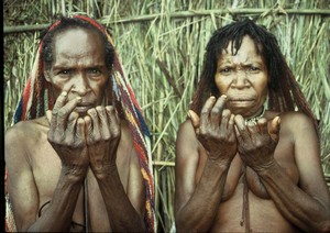
Danis is an indigenous tribe that lived in the Baliem valley at the time of its discovery. Danis belong to some of the "decorative" tribes in West Papua.


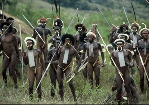
Their penchant for "fancy dress" shows most of the time of the war. You've probably seen the famous photo of the Dani tribe members, with boar's tusks in their noses, and hats with feathers Paradise. The men wear long, thin koteka Dani. The women wear short skirts Danis woven from fibers of orchids, decorated with straw and woven bags with essential called "noken" in the back. As women of the tribe Yali, women wear short skirts Dani under their butts.

Despite Danis were discovered relatively late - in 1938, became one of the best known tribes in New Guinea. Dani held one of the most fertile parts of Papua. As a result, they often had to fight for their territory. There were frequent wars among themselves Danis. They were the most formidable headhunters on the island tribe, which is even more remarkable when you consider that eat their enemies, like most of the tribes of Papua others did.


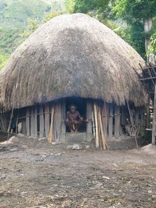
Dani build round or oval huts, and their villages are enclosed by fences. They are farmers, and their small fields are distinctly bordered. This is what helped Richard Archbold spot them from the plane. The Dani tribe’s customs and culture are very rich and interesting. Several pages could be written on these topics.
His penchant for "dress" the majority of the sample in time of war. You've probably seen the photos of the famous members of the Dani tribe, with boar tusks in their noses, and hats with feathers of birds of paradise. The men wear long, thin koteka Dani. Danis The women wear short skirts woven from fibers of orchids adorned with woven straw and bags key called "noken" on the back. As women Yali tribe, the Dani women wear short skirts below their buttocks.

Despite the fact that Danis was discovered relatively late - in 1938, became one of the most famous tribes in New Guinea. Dani on a fertile part of Papua. As a result, often had to fight for their territory. There was also a frequent wars between them Danis. They were the most feared headhunting tribes of the island, which is all the more, if we do not eat their enemies, like most other tribes have made Papua.


Nias Island

0 comments

Located 125 km onshore Sumatra, the island of Nias is famous for its' megalith altars, spectacular traditional architecture and the complexity of religious sites. This isolated island possession on undulating terrain of mountains, valleys, gorges and rivers. North of this island is sparsely populated.

The local call their land as Tano Niha or "land of the people" as they are called the same as Ono Noha. Nias ethnic they are involved in the ethnic-Malay Ptoto, again obtained with the Asian Proto-Mongolian world. Nias speak a kind of language related to Madagascar. Because of the similarity of language, customs, the body size of Batak of Sumatra Nias with the mainland, it is possible that the island of Nias has derived Batak.

According to customary law, there are three classes of Nias, namely the aristocracy, ordinary people and slaves. The number of owned ointments, which represents the social status of a family. People used to be scarred for a particular purpose. A young man must serve the family of his future wife for some time before the wedding.

War as a dance in South Nias, Indonesia is only a highly qualified dance performing acrobatic jumps. The Warrior Dance is a mesmerizing dance song scary voice rattling shields, men shouted, jumping like a frog in the air. Niasers also perform mock battles and armed struggle. They receive a horned helmet, shoulder boards flaring, boar tusk protruding facial mask, a double-edged sword, sharp spears to hit the enemy physiologically.

A culture of Nias, which still exists is the jumping rock, or locally called fahombe. Fahombe performed according prove beyond a man to his wife. The man had to jump over a stone table two meters high. In the past, the top of the stone table is covered with spikes and sharp bamboos. Tactically, this stone jumping also means educating young warrior facing the wall of their enemy with a torch in one hand a sword in the other night. Pierre jumps ever conducted in villages in South Nias.


Nias attractions has many historical remains and unique culture to enjoy. Megalithic stone unique clan houses, and their war dance are among the attractions. The environment is the car offers a challenge to ride a wave on the planet.


Navigating the best time to surf Nias is from June to October with the biggest swells, but the rest of the year is ideal for those who want smaller waves.

NIAS has one of the best right-handed in Indonesia. It is located at the western end of the bay and can hold up lagundi 15 feet. There is also an excellent left reef break that works for more than four feet. If you are looking for hollow, deep waves of Nias is definitely worth a visit. There are also many other places to explore like the Hinako Islands.

SIBERUT ISLANDS

0 comments

Siberut island recently received international attention on the primary conservation area, and the unique culture of ethnic Mentawaian endemicity and its bio-diversity must be maintained. Although the island has much to offer, the possibilities are not fully exploited, particularly for tourism.

Most visitors to the island is only interested in seeing the culture of indigenous tribes such as the common life in the clan of the traditional house UMA along the bank.

Siberut National Park occupies the western half of the island's north coast. Today, biodiversity conservation integrated project, organized by PHPA, Ministry of Finance, in collaboration with local communities, local NGOs and other institutions, conducts the program of community-based conservation.

Siberut Island (4.030 km ²) is the largest island in the archipelago of four islands Mentawaian. It is located about 155 km from the west coast of Sumatra, the Straits of all Mentawaian. Mentawaian islands belong administratively Kabupaten (Regency), Padang Pariaman in the province of West Sumatra. Siberut is divided into two Kecamatan (district): North and South centers Muara Siberut and Muara Siberut administrative Sikabaluan who is also a service to the market centers of Siberut.

According to the Forestry Ministerial Decree (No. 407/Kpts II/93 dated 10-VII-93), an area of ​​190,500 hectares was declared Siberut National Park in 1993.

TOPOGRAPHY AND CLIMATEThe Siberut Island is characterized by a wet equatorial climate, with minimum and maximum temperatures of 22 ° C (71.6F) and 31 ° C (87.8F). The dry season is from February to June and the rainy season is from July to January. Siberut is hilly with steep slopes. Almost 60% is covered by tropical forests, many forest types, such as: primary dipterocarp forest, primary forest, mixed forest swamps, mangroves and Barringtonia. In addition, many rivers in the islands with a complex system of tributaries.

PLACES OF INTEREST INTERESTSome and interesting things to see are:

Community and Culture: Although Siberut is only a small island, the internal variations in language, culture, lifestyle, and resources is very important. There is no clear indication of when man first arrived on Siberut, but suggest that the anthropologist Batak of North Sumatra settled in the island several thousand years. In many ways, the people of Siberut are among the most archaic in Indonesia.

Mentawaian patrineal groups are traditionally organized and social life around the house along the municipal UMA, which took place in the clan of people related through a common ancestor. UMA size varies between 30-80 members, who are in nuclear family units called LALEP. Since the internal friction, the clan may be divided to form a new group or a single family.

Mentawaians believe that all living objects, men, animals and plants are presumably life. Only the expert community is a sorcerer, Kerea, responsible for communication with the spirits and souls. In case of accident or illness, is called to restore harmony in a group or in relation to the spirits of the environment. Taboo to develop a system based on religious beliefs in relation with the environment is the dominant feature of traditional life in Siberut.

Visit and stay in a village Mentawai walk in the forest, see the treatment and processing of barkcloth of sago, and other activities that increase the interest and fascination with the natural philosophy of Mentawaians.

Jungle Adventure: very few visitors have explored the island densely Fresta. Inside the national park adventures pleasant surprises await the visitor. Visit a cave in central Siberut or waterfalls in the north and south of the island, are available upon request from your guide. Be aware of your surroundings. You may have the opportunity to see and hear some fauna. Siberut has four endemic primates in the local names are called Bilu (Hylobates Kloss) Simakobu (Simi concolor), Bokoi (Macaca pagensis) and Joja (Presbytis Potenziani). There are at least five species of squirrels and birds abound in the island. Fill a canoe ride on muddy trails shippery balanced on a log, wading a shallow river, brushing through a dense jungle - are all part of an unforgettable adventure in the jungle of Siberut.

Siberut island recently received international attention on the primary conservation area, and the unique culture of ethnic Mentawaian endemicity and its bio-diversity must be maintained. Although the island has much to offer, the possibilities are not fully exploited, particularly for tourism.

Most visitors to the island are only interested in seeing the culture of the indigenous tribes, as the community life of the clan in a traditional house of the river along the UMA.

Siberut National Park is located in the western part of the 'island of the coast. At the time, took the conservation of biodiversity, organized by PHPA, MOF together with local authorities, local NGOs and other institutions, will make the Community-based conservation program.

Siberut Island (4.030 km ²) is the largest island in the archipelago of four islands Mentawaian. It is located about 155 km from the west coast of Sumatra, the Straits of all Mentawaian. Mentawaian islands belong administratively Kabupaten (Regency), Padang Pariaman in the province of West Sumatra. Siberut is divided into two Kecamatan (district): North and South centers Muara Siberut and Muara Siberut administrative Sikabaluan who is also a service to the market centers of Siberut.

According to the Decree of the Ministry of Forestry (No 407/Kpts II/93, dated 10-VII-93), 190 500 hectares of area has been declared Siberut National Park in 1993.

Topography and CLIMATEThe Siberut Island is characterized by a wet equatorial climate, with minimum and maximum temperature of 22o C (71.6F) and 31 ° C (87.8F). The dry season is from February to June and the rainy season is from July to January. Siberut is hilly with wide variations in height. Nearly 60% is covered by tropical forest with many forest types such as: primary dipterocarp forest, primary forest mixed swamp forest, mangrove forest and Barringtonia. There are many rivers on the islands with a complex system of tributaries.

PLACES INTERESTSome interesting objects to see are:

Community and Culture: Although Siberut is only a small island, the internal variations in language, culture, lifestyle, and resources is very important. There is no clear indication of when man first arrived on Siberut, but suggest that the anthropologist Batak of North Sumatra settled in the island several thousand years. In many ways, the people of Siberut are among the most archaic in Indonesia.

The Mentawai are traditionally organized in the life of social groups and patrineal around the UMA, a communal house, which has long held a clan of people united by a common ancestor. UMA range in size from 30 to 80 members in the nuclear family units, called LALEP. Due to internal friction, the clan may break away and form a new group or family.

The Mentawaians believe that all living beings, men, plants and animals likely to have alcohol. The only specialist in community medicine KEREI is the man responsible for communication with the spirits and souls. In case of accident or illness, he is called to restore harmony in the group or in connection with the spirits in the environment. A system based on religious beliefs Taboo draw regarding the environment is a dominant feature of traditional life on Siberut.

Visit and stay in a village Mentawaian, trek in the jungle, learn about the treatment and processing of sago bark cloth, and perform other activities that will increase your interest and fascination of the natural philosophy Mentawaians .

Jungle Adventure: very few visitors have explored the thickly frested island. In the National Park of pleasant surprises awaiting visitors adventures. Visiting a cave in central Siberut, or cascades, the north and south of the island, you can request, with your guide. Be observant of your surroundings. You may be able to see and hear some of the endemic wildlife. Siberut has four endemic primates, which are called local names Bilou (Hylobates Kloss), Simakobu (Simias concolor), Boko (Macaca pagensis), and JOJA (Presbytis Power). There are at least five species of squirrels and chipmunks, and abundance of birds across the island. Fill a canoeing is balancing on a log shippery muddy trails, forded a shallow river, brushing through a dense jungle - are all part of an unforgettable adventure in the Siberut jungle.


    Dayak Tribe Travel Information

    Thursday, September 29, 2011 0 comments

    By visiting Palangkaraya, just look outside your window air and watch the green field of nature below the cut by a small river with a slow roll during passage downstream of the mangrove forest. The flow is similar to the dragon's head with the body without end.

    When the area of ​​forest that seems to be far apart and of course, Palangkaraya city appears as if out of the rainforest. Central Kalimantan has great potential for tourism and natural resources. Planting, forestry, fishing, mining and ranching can attract curious visitors. On the other hand, the diversity of ethnic groups is interesting. Three main tribes in this region are Dayak Ot Danum and Ma'anyan Ngaju Dusun tribe.

    Curious? Outputs of your routine and enjoy the differences between the other Dayak life.

    It

    By Garuda Indonesia Airlines' domestic flights directly to Palangkaraya three times a day. In Palangkaraya, you should book a travel package that includes a visit to a village Dayak. Some packages even include live with them.

    Movement

    You must go back to Palangkaraya to rent a car or book a trip as you can ask the guide to show you anywhere you want. The wizard will give you a prediction on the time it takes to get there and what you can do to make the experience enjoyable.

    Palangkaraya

    Palangkaraya, the local language means Dayak 'holy container' Palangkaraya. Palangkaraya is easily accessible from Jakarta, Banjarmasin, Samarinda, Balikpapan and other places on the island by air. The city was the center of government, commerce and education in the province. The Regional Museum of Palangkaraya contains a collection of historical and cultural interest from all over Central Kalimantan.


    Source

    Bull Race Karapan Sapi Madura

    0 comments

    Parties in Indonesia are rich and colorful. These festivals attract many tourists from all over the world. Keeping in line with the different religious and caste in Indonesia, festivals and events here are so different and colorful, and invite participants to a local here. Kerapan SAPI (Bull Race) is a major event here.

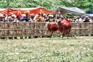
    The SAPI Kerapan (Bull Race) is an annual event that attracts visitors and enthusiasts from various parts of Indonesia and the world. The SAPI Kerapan (Bull Race) is held in Madura Island. These races are very unique bulls in Madura Island. The SAPI Kerapan (Bull Race) was born the custom of the race team competing against each other and hunting through the barren fields. He was sporting a love of a king at the beginning of Sumenep, one of the cities on the island. The SAPI Kerapan (Bull Race) today, from August to October. This festival offers an opportunity for local festivals pay too generous to follow the races. The bull run finally reach the grand final held in Pamekasan, the capital. Before the start of the race of the bulls are exhibited in the cities, decorated with flowers, ribbons and gold halter. It's really a beautiful sight to see different bulls wearing a colorful parade and on the road.

    While the gamelan musicians Divertimento bulls, they are fed Arak (south-east Asia with a powerful spirit rice wine). This is done to excite the bulls for the race. Only then they will be free at the expense of the track, or the public, which sometimes happens. The race does not take much time that man bulls record breaking 100 meters, crossing the distance in just nine seconds. The SAPI Kerapan (Bull Race) will start from 9:00 ET until this year.

    Kerapan SAPI (Bull Race) is full of excitement and suspense. You will definitely enjoy every moment of the race.

    Beatifull Puncak Pass

    Tuesday, September 27, 2011 0 comments

    Between Bandung and Bogor, Puncak mountain in the game, a cold, which is very popular. Jakarta dwellers spend their weekends and holidays from the heat and the busy streets of the capital of Indonesia to Puncak. Bandung to Puncak takes about 3 hours by car. Puncak pass area has long been a weekend for residents of the entire capital of Indonesia. The fresh air and beautiful view offers a sense of calm, peaceful and quiet. In the afternoon, sunsets from the top of the pass can be quite spectacular.

    Puncak Pass is one of the interesting objects in the province of West Java. It is located south of Jakarta and is within an hour away. Puncak is the ideal place for a weekend and a good location to find the fresh mountain air. In addition, there are many attractions nearby, such as Bogor and Cobodas Botanic Gardens, Pangrango Gede National Park, Safari Park and the plantations.

    Puncak Indah comprises three districts: Ciawi, Megamendung, Cisarua. The area is known for its fresh air and beautiful scenery. In Ciawi of Cipanas, there are many bungalows, hotels, motels, restaurants and other tourist facilities. Puncak tourist object is Lido Park, located in the village Cigombong / Wates Jaya (km. 21), chap. Ciawi-Sukabumi, Cijeruk. The facilities offered ara Park Lido restaurant, chalets, swimming, camping and other recreational facilities of the lake. Gunung Mas XII Plantation, located in Puncak Rd, Cisarua district. It offers panoramic views of the mountain that could not be found in Puncak. Activities that can be done on foot include tea and watch the making of tea picking until the tea is ready to serve.


    Dive Banda with Spice Island Divers

    Monday, September 26, 2011 0 comments

    Spice Island Divers is the only country in sub-Banda diving center. Owned and operated by a multinational management team, proud of operation of the service and professionalism, despite the remote location in India.

    Banda has long been thought to target only be left with the ships cruise the plunge, with limited routes to limit the time you can spend the Banda islands. Banda shore diving allows divers to enjoy scuba diving experiences in a more flexible, more time to dive into a series of sites in the port of Banda enormous natural, and also participate in excursions in the area of ​​the outer.

    Nestlé islands in the Banda Sea, eastern Indonesia, reached through the central hub of Maluku, Ambon. Banda archipelago consists of seven main islands are Banda Neira, Lonthor, Gunung Api, plantains Pulau Hatta, Ai and Run.

    Asmat Tribe

    0 comments

    Asmat – The head-hunters – West Papua

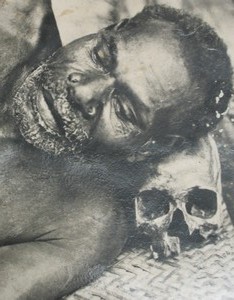
    Asmat cannibal tribe is the most famous of Papua. They put human skulls under their heads instead of a pillow. They feed on the brains of animals mixed with sago worms directly from your skull in half. They live in small islands of mangrove vegetation near the sea on the south side of the western part of the island of New Guinea. The construction of communal houses Asmat, they live together. Each family has its own fireplace reserved. In the longhouse, six or ten members of the band live.

    In addition, the Asmat were headhunters, but also "hunt for the names." Each person is called after someone has died, or after killing the enemy. The child was given a name sometimes up to ten years after its birth, and then left the village to kill his enemy in the vicinity of the village. They had to learn the name of the man he killed, and then brings her home village of the skull. Only in this way a person can have a name.

    Komodo Island

    0 comments

    Location:

    Komodo National Park is located between the islands of Sumbawa and Flores in the Sunda Islands Minor, a distance of 200 nautical miles east of Bali. It has a total area of ​​75 000 hectares and includes many islands, the largest of which are Komodo (34000 hectares), Rinca (20,000 hectares), Padar, Nusa Kode, Motang, a series of smaller islands, and the sanctuary is WAE Wuul Flores. A total of 112 500 hectares of surrounding waters are also the jurisdiction of the Park Rangers.

    Bunaken National Park

    Sunday, September 25, 2011 0 comments

    unaken National Park is very representative of Indonesian tropical water ecosystems, consisting of the plain sea grass, coral reefs and terrestrial / coastal.

    Park covers an area north of the islands of Bunaken, Manado Tua, Montehage, Siladen, Nain and Nain Kecil, Tanjung Pisok and part of the coastal area. Some South Park covers part of the Tanjung Kelapa coast.

    BOROBUDUR - The Biggest Buddhist Temple in the Ninth Century

    0 comments

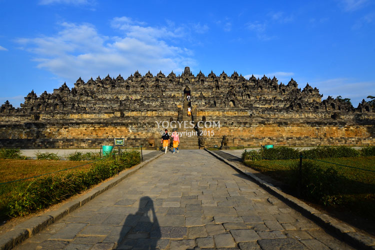
    Who does not know Borobudur? This Buddhist temple has 1460 relief panels and 504 Buddha images of the complex. Millions of people are eager to visit this building as one of the wonders of the world heritage. It is not surprising, since architecturally and functionally, as a place for Buddhists to say their prayer, Borobudur is attractive.

    Borobudur was built Samaratungga King, one of the kings of Old Mataram Kingdom, the descendant of the dynasty sailendra. Kayumwungan based on the script, called the Indonesian Borobudur Kandahjaya Uday has revealed that it was a place to pray for the intention of building was completed on 26 May 824, almost one hundred years, construction was begun. The name of Borobudur, as some say, means a mountain with terraces (budhara), while the other says that Borobudur means monastery in a higher place.

    Borobudur is constructed as a ten-terraces building. The height before being renovated, 42 meters and 34.5 meters after the renovation because the lowest level was used as a base of support. The first six terraces are square, two upper terraces are circular, and above them is the terrace where the Buddha statue to the west. Each terrace symbolizes the stage of human life. In line with of Buddha Mahayana, anyone who intends to attain the Buddha has to go through every stage of life.

    Visa-on-arrival: June 2010, Aceh Visa on Arrival (VOA) is available in the province of Aceh, Sultan Iskandar Muda International Airport. VOA reaches people from 63 countries. The VOA is valid for 30 days and are expandable up to another 30 days, which applies to immigration offices in Indonesia. Every visitor to the use of Aceh VOA enter will be charged USD 25. Direct flights to Banda Aceh to Jakarta, Medan, Penang and Kuala Lumpur

    The Land of Plenty cafes coffee, Aceh is unique and tasty. The most famous is the Gayo Mountain Coffee Uleekareng and coffee. There are hundreds of quality cafes around Banda Aceh. Coffee consumption in the province of Aceh community has been very popular and is an important part of a social activity. Thus, while in the province of Aceh, be sure to stop at a coffee!

    The base of Borobudur, called Kamadhatu, symbolizes human being that are still bound by lust. The upper four stories are called Rupadhatu symbolizing human beings that have set themselves free from lust but are still bound to appearance and shape. On this terrace, Buddha effigies are placed in open space; while the other upper three terraces where Buddha effigies are confined in domes with wholes are called Arupadhatu, symbolizing human beings that have been free from lust, appearance and shape. The top part that is called Arupa symbolizes nirvana, where Buddha is residing.
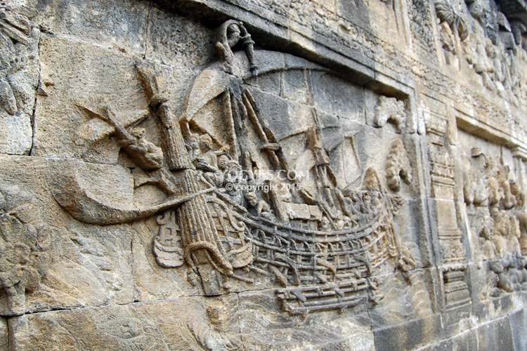
    Each terrace has beautiful relief panels showing how skillful the sculptors were. In order to understand the sequence of the stories on the relief panels, you have to walk clockwise from the entrance of the temple. The relief panels tell the legendary story of Ramayana. Besides, there are relief panels describing the condition of the society by that time; for example, relief of farmers' activity reflecting the advance of agriculture system and relief of sailing boat representing the advance of navigation in Bergotta (Semarang).
    All relief panels in Borobudur temple reflect Buddha's teachings. For the reason, this temple functions as educating medium for those who want to learn Buddhism. YogYES suggests that you walk through each narrow passage in Borobudur in order for you to know the philosophy of Buddhism. Atisha, a Buddhist from India in the tenth century once visited this temple that was built 3 centuries before Angkor Wat in Cambodia and 4 centuries before the Grand Cathedrals in Europe.
    Thanks to visiting Borobudur and having supply of Buddha teaching script from Serlingpa (King of Sriwijaya), Atisha was able to improve Buddha's teachings after his return to India and he built a religion institution, Vikramasila Buddhism. Later he became the leader of Vikramasila monastery and taught Tibetans of practicing Dharma. Six scripts from Serlingpa were then summarized as the core of the teaching called "The Lamp for the Path to Enlightenment" or well known as Bodhipathapradipa.
    A question about Borobudur that is still unanswered by far is how the condition around the temple was at the beginning of its foundation and why at the time of it's finding the temple was buried. Some hypotheses claim that Borobudur in its initial foundation was surrounded by swamps and it was buried because of Merapi explosion. It was based on Kalkutta inscription with the writing 'Amawa' that means sea of milk. The Sanskrit word was used to describe the occurrence of disaster. The sea of milk was then translated into Merapi lava. Some others say that Borobudur was buried by cold lava of Merapi Mountain.
    With the existing greatness and mystery, it makes sense if many people put Borobudur in their agenda as a place worth visiting in their lives. Besides enjoying the temple, you may take a walk around the surrounding villages such as Karanganyar and Wanurejo. You can also get to the top of Kendil stone where you can enjoy Borobudur and the surrounding scenery. Please visit Borobudur temple right away.

    A Little Bit About Aceh

    Saturday, September 24, 2011 0 comments


    Aceh (pronounced ah-chay) is an autonomous territory of Indonesia, located on the northern tip of Sumatra island. Aceh is where Islam was first established in Southeast Asia. In the seventeenth century the Sultanate of Aceh was the richest state, powerful and cultivated in the Straits of Malacca. Aceh was the nearest point of land to the epicenter of the earthquake of 2004, the vast Indian Ocean triggered a tsunami that devastated much of the west coast of the region, including Banda Aceh. With the help of the international community and the strong spirit of its inhabitants, Aceh was able to "build back better '. Most areas of Aceh are covered with forests, rich in economic products of oil and gas and other agricultural products.
    Source

     
    Around Indonesia © 2011 | Designed by Interline Cruises, in collaboration with Interline Discounts, Travel Tips and Movie Tickets