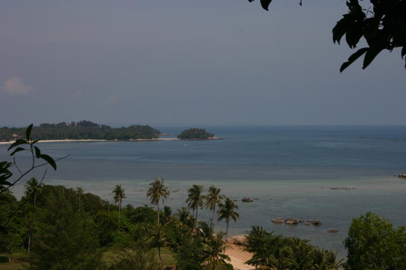
Indonesia is the largest archipelago in the world. It consists of five major islands and about 30 smaller groups. The figure for the total number of islands is 17,508 according to the Indonesian Naval Hydro-Oceanographic office. The archipelago is on a crossroads between two oceans, the Pacific and the Indian ocean, and bridges two continents, Asia and Australia. This strategic position has always influenced the cultural, social, political and economic life of the country.
The territory of the Republic of Indonesia stretches from 6o08' north latitude to 11o15' south latitude, and from 94o45' to 141o05' east longitude. The Indonesian sea area is four times greater than its land area, which is about 1.9 million sq. km. The sea area is about 7.9 million sq. km (including an exclusive economic zone) and constitutes about 81% of the total area of the country.
The five main islands are: Sumatra, which is about 473,606 sq. km. in size; the most fertile and densely populated islands, Java/Madura, 132,107 sq. km; Kalimantan, which comprises two-thirds of the island of Borneo and measures 539,460 sq. km; Sulawesi, 189,216 sq. km; and Irian Jaya, 421,981 sq. km, which is part of the world's second largest island, New Guinea. Indonesia's other islands are smaller in size.
The archipelago is divided into three groups. The islands of Java, Sumatra and Kalimantan, and the small islands in-between, lie on the Sunda Shelf which begin on the coasts of Malaysia and Indo China, where the sea depth does not exceed 700 feet. Irian Jaya which is part of the island of New Guinea, and the Aru Islands lie on the Sahul Shelf, which stretches northwards from the Australian coast. Here the sea depth is similar to that of the Sunda Shelf.
Located between these two shelves is the island group of Nusatenggara, Maluku and Sulawesi, where the sea depth reaches 15,000 feet. Coastal plains have been developed around the islands of Sumatra, Java, Kalimantan and Irian Jaya.
The land area is generally covered by thick tropical rain forests, where fertile soils are continuously replenished by volcanic eruptions like those on the island of Java.
The country is predominantly mountainous with some 400 volcanoes, of which 100 are active. Mountains higher than 9,000 feet are found on the islands of Sumatra (Mt. Leuser and Mt. Kerinci), Java (Mt. Gede, Mt. Tangkubanperahu, Mt. Ciremai, Mt. Kawi, Mt. Kelud, Mt. Semeru and Mt. Raung), Sulawesi (Mt. Lompobatang and Mt. Rantekombala), Bali (Mt. Batur and Mt. Agung), Lombok (Mt. Rinjani) and Sumbawa (Mt. Tambora). The highest mountain is the perpetually snow-capped Mandala Top (15,300 feet) in the Jaya Wijaya mountain range of Irian Jaya.
Many rivers flow throughout the country. They serve as useful transportation routes on certain islands, for example, the Musi, Batanghari, Indragiri and Kampar rivers in Sumatra; the Kapuas, Barito, Mahakam and Rejang rivers in Kalimantan; and the Memberamo and Digul rivers in Irian Jaya. On Java rivers are important for irrigation purposes, i.e., the Bengawan Solo, Citarum and Brantas rivers.
A number of islands are dotted with scenic lakes, like the Toba, Maninjau and Singkarak lakes on Sumatra; the Tempe, Towuti, Sidenreng, Poso, Limboto, Tondano, and Matana lakes on Sulawesi; and the Paniai and Sentani lakes on Irian Jaya.
CLIMATE AND WEATHER
The climate and weather of Indonesia is characterized by two tropical seasons, which vary with the equatorial air circulation (the Walker circulation) and the meridian air circulation (the Hardley circulation). The displacement of the latter follows the north-south movement of the sun and its relative position from the earth, in particular from the continents of Asia and Australia, at certain periods of the year. These factors contribute to the displacement and intensity of the Inter-Tropical Convergence Zone (ITCZ) which is an equatorial trough of low pressure that produces rain. Thus, the west and east monsoons, or the rainy and dry seasons, are a prevalent feature of the tropical climate.
The Main Seasons
The climate changes every six months. The dry season (June to September) is influenced by the Australian continental air masses; while the rainy season (December to March) is the result of the Asian and Pacific Ocean air masses. The air contains vapor which precipitates and produces rain in the country. Tropical areas have rains almost the whole year through. However, the climate of Central Maluku is an exception. The rainy season is from June to September and the dry season from December to March. The transitional periods between the two seasons are April to May and October to November.
Temperature and Humidity
Due to the large number of islands and mountains in the country, average temperatures may be classified as follows:
coastal plains: 28oC
inland and mountain areas: 26oC
higher mountain areas: 23oC, varying with the altitude.
Being in a tropical zone, Indonesia has an average relative humidity between 70% and 90%, with a minimum of 73% and a maximum of 87%.
TERRITORIAL WATERS AND EXCLUSIVE ECONOMIC ZONE
When independence was proclaimed and sovereignty gained, Indonesia had to enact laws to govern the seas in accordance with the geographic structure of an archipelagic state. This, however, did not mean that the country would bar international passage. The laws were necessary instruments for the unity and national resilience of the country, with a territory that embraces all the islands, the islets and the seas in between.
In view of the country's susceptibility to foreign intervention from the sea and for domestic security reasons, on December 13, 1957, the Indonesian Government issued a declaration on the territorial waters of the Republic. It stated that all the waters surrounding and between the islands in the territory came within Indonesia's sovereignty. It also determined that the country's territorial water limit was 12 miles, measured from a straight baseline drawn from the outermost points of the islands.
In the past, archipelagic states like Indonesia have unilaterally determined their 200-mile-Exclusive Economic Zones. Today such economic zones are confirmed by the International Convention on the Law of the Sea, which was ratified by the Indonesian Government on October 18, 1983, by Act No. 5 of the same year. This is the legal basis of the Indonesian-Exclusive Economic Zone.
FLORA
The rich flora of Indonesia includes many unique varieties of tropical plant life in various forms. Rafflesia arnoldi, which is found only in certain parts of Sumatra, is the largest flower in the world. This parasitic plant grows on certain lianas but does not produce leaves. From the same area in Sumatra comes another giant, Amorphophallus tatinum, the largest inflorescence of its kind.
The insect trapping pitcher plant (Nepenthea spp) is represented by different species in many areas of western Indonesia.
The myriad of orchids is rich in species, varying in size from the largest of all orchids, the tiger orchid or Grammatophyllum Speciosum, to the tiny and leafless species of Taeniophyllum which is edible and taken by the local people as a medicine and is also used in handicrafts. The forest soil is rich in humus which enables the luxuriant growth of a multitude of fungi, including the horse hair blight, the luminescent species, the sooty mold and the black mildew.
Indonesia's flora also abounds in timber species. The dipterocarp family is renowned for its timber (meranti), resin, vegetable oil and tengkawang or illipe nuts. Ramin, a good-quality timber for furniture, is produced by the Gonystylus tree. Sandalwood, ebony, ulin and Palem-bang timber are other valuable forest products. Teakwood is a product of man-made forests in Java.
Because the flora is so rich many people in Indonesia have made a good living of this natural resource. About 6,000 species of plants are known to be used directly or indirectly by the people. A striking example in this modern time is the use of plants in the production of traditional herbal medicine or "Jamu". Flowers are indispensable in ceremonial, customary and traditional rites.
To care for animals and plants in the country, the fifth of November was designated as the national Flora and Fauna Day. To foster the society's love for its fauna and flora, the Komodo reptile (Varanus komodoensis) has been designated as Indonesia National Animal, the red freshwater Liluk/arwana (Scleropage formosus) as the Fascinating Animal and the flying Elang Jawa (Javan Hawk Eagle, Spizaetus bartelsi) as the Rare (endangered) species. These decisions complement the previous designation of Indonesia's national flowers.
INDONESIA STANDARD TIME
As of January 1, 1988, Indonesia's three time zones have been changed as below:
- Western Indonesia Standard Time equals GMT plus 7 hours (meridian 105oE), covering all provinces in Sumatra and Java, and the provinces of West and Central Kalimantan.
- Central Indonesia Standard Time equals GMT plus 8 hours (meridian 120oE), covering the provinces of East and South Kalimantan, all provinces in Sulawesi, and the provinces of Bali, West and East Nusatenggara and East Timor.
- Eastern Indonesia Standard Time equals GMT plus 9 hours (meridian 135oE), covering the provinces of Maluku and Irian Jaya.
| Location: |
| Southeastern Asia, archipelago between the Indian Ocean and the Pacific Ocean |
|
| Geographic coordinates: |
| 5 00 S, 120 00 E |
|
| Area: |
| total: 1,904,569 sq km country comparison to the world: 16 land: 1,811,569 sq km water: 93,000 sq km |
|
| Area - comparative: |
| slightly less than three times the size of Texas |
|
| Land boundaries: |
| total: 2,830 km border countries: Timor-Leste 228 km, Malaysia 1,782 km, Papua New Guinea 820 km |
|
| Coastline: |
| 54,716 km |
|
| Maritime claims: |
| measured from claimed archipelagic straight baselines territorial sea: 12 nm exclusive economic zone: 200 nm |
|
| Climate: |
| Current Weather tropical; hot, humid; more moderate in highlands |
|
| Terrain: |
| mostly coastal lowlands; larger islands have interior mountains |
|
| Elevation extremes: |
| lowest point: Indian Ocean 0 m highest point: Puncak Jaya 5,030 m |
|
| Natural resources: |
| petroleum, tin, natural gas, nickel, timber, bauxite, copper, fertile soils, coal, gold, silver |
|
| Land use: |
| arable land: 11.03% permanent crops: 7.04% other: 81.93% (2005) |
|
| Irrigated land: |
| 45,000 sq km (2003) |
|
| Total renewable water resources: |
| 2,838 cu km (1999) |
|
| Freshwater withdrawal (domestic/industrial/agricultural): |
| total: 82.78 cu km/yr (8%/1%/91%) per capita: 372 cu m/yr (2000) |
|
| Natural hazards: |
| occasional floods; severe droughts; tsunamis; earthquakes; volcanoes; forest fires volcanism: Indonesia contains the most volcanoes of any country in the world - some 76 are historically active; significant volcanic activity occurs on Java, western Sumatra, the Sunda Islands, Halmahera Island, Sulawesi Island, Sangihe Island, and in the Banda Sea; Merapi (elev. 2,968 m, 9,737 ft), Indonesia's most active volcano and in eruption since 2010, has been deemed a "Decade Volcano" by the International Association of Volcanology and Chemistry of the Earth's Interior, worthy of study due to its explosive history and close proximity to human populations; other notable historically active volcanoes include Agung, Awu, Karangetang, Krakatau (Krakatoa), Makian, Raung, and Tambora |
|
| Environment - current issues: |
| deforestation; water pollution from industrial wastes, sewage; air pollution in urban areas; smoke and haze from forest fires |
|
| Environment - international agreements: |
| party to: Biodiversity, Climate Change, Climate Change-Kyoto Protocol, Desertification, Endangered Species, Hazardous Wastes, Law of the Sea, Ozone Layer Protection, Ship Pollution, Tropical Timber 83, Tropical Timber 94, Wetlands signed, but not ratified: Marine Life Conservation |
|
| Geography - note: |
| archipelago of 17,508 islands (6,000 inhabited); straddles equator; strategic location astride or along major sea lanes from Indian Ocean to Pacific Ocean |